 |
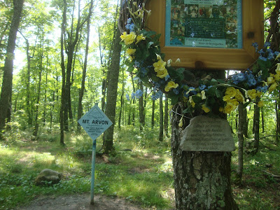
| Benchmark at the top of the hill |
On the other hand, if you're out in Colorado or Wyoming, it's a given there's going to be some serious climbing involved -- no short, easy hikes or driving up to paved a parking lot or discovering benches waiting for you at the top. Wikipedia notes that anyone planning to bag the Wyoming high point should plan on a 4 to 6 day hiking trip; it's considered a difficult ascent.
So where does Mount Arvon fall? Well, it's not as easy to get to as the state high points that are also state parks, like in Alabama. No nicely paved road culminating in a large, paved parking lot. Still, there is a road, sort of, that does end in a parking area.
Not that we were able to park in said lot: it was crammed full of ORVs. Those machines are like snowmobiles, apparently genetically engineers to always travel in packs. You know, I get the attraction of being the lead dog in one of those ORV caravans: you get to see the trail in all its splendor, you're the first one through the mudholes, you don't eat anyone's dust. But if you're the last in line when there are several dozen ORVS ahead of you, all kicking up rocks and splattering everyone with mud, what is the point? (Actually, I know what the point is -- ORV trails, just like snowmobile trails that often follow the same routes, are always conveniently located to loop past watering holes with malt beverages on tap. It's not the time on the trail people crave; it's the time at the bar.)
Back to Mount Arvon. The road is dirt, and the last 400 feet or so were not something I'd particularly want to go over in a low-clearance vehicle, but it is a road. You go from well-maintained two lane gravel to more like single lane gravel that winds a bit to something that's one step above a two track. The route ambles through mature hardwood forest, some of which is currently being harvested -- saw a John Deere forwarder in action that has to be one of the niftiest machines I've seen in awhile (the rotating cab has to be one of the coolest features of all time) -- and is pretty typical U.P. backwoods, although no doubt more well traveled than most. There is a way to get to Mount Arvon from where we live that would involve only backwoods roads but we opted for the tourist brochure drive.
The route is clearly marked -- each time we were confronted with a choice of routes, there was signage to indicate turns. Dito when we got to the top of the mountain: there was a large sign in the parking area showing the layout: there's a short hiking trail that loops from the parking lot to the high point, from the high point down to an overlook that on a truly clear day would probably let you see right over Point Abbaye to the Keweenaw, and from the overlook back to the parking lot. There's a bench and picnic table at the high point; there's another bench at the overlook. There's also the obligatory logbook so you can record your name and the date.
I was never quite sure what to tell tourists when they asked at the museum about the drive out to Mount Arvon. Now I know: don't do it in low-slung car, at least not all the way. Watch for logging trucks. And if you're really lucky, you'll get to see something like this in action:


I understand the attraction: there are hundreds of sites here in Maine that my wife and I have never visited. I sometimes meet tourist that ask me if I have seen _____ and I have to admit: No.
ReplyDeleteseems a shame
the Ol'Buzzard
everything in texas is 500 miles away.
ReplyDeleteSometimes I think an ATV would be cool to have but there is so much private land in Texas there isn't a lot of places I could use one. I haven't been to it but I live not far from a marker that claims to be the center of Texas.
ReplyDeleteLooks like a gentle, pleasant hike. Wondering what they are going to do with all those saplings. Not big enough to mill into lumber. Pulp, maybe?
ReplyDeleteThat would be my guess. They're too small for anything else, although maybe chipped they could be used for OSB.
Delete