Showing posts with label National Parks. Show all posts

Tuesday, January 31, 2023

Out and About in Arkansas, Part II


AKA the State and Federal Parks edition. 

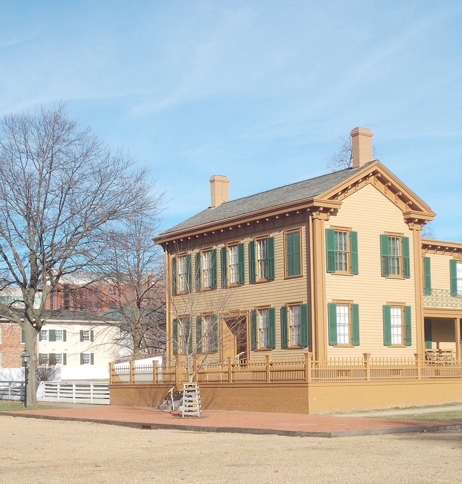
In addition to the obvious national park, the one that's the easiest to get to*, the incredibly photogenic one from the view point of a former architectural historian (see photo above), we've visited a couple other parks in the past couple of weeks. 

First up was the William Jefferson Clinton Birthplace Home National Historic Site (WICL), the place Clinton and his mom called home for the first four years of his life. The park was a first for me: I took zero photos. Maybe it was just too gray a day. The photo of the house I'm using in this post is courtesy of the National Park Service.

The park was interesting, but probably not in the way that supporters of the park would appreciate. Before I saw it, I'd been thinking "Why?" As in "why is it a National Park Service site?" And I'm still thinking that. I don't buy the argument that just because someone was President that automatically makes places that person lived historically significant. And even if the places associated with a past President merit preservation and interpretation, not every one of them requires National Park Service management. The Clinton early childhood home could have easily remained in private nonprofit organization hands or become a state park, but, nope, the NPS got stuck with another money pit. (The house has foundation issues. Work that would cost a private homeowner or a local nonprofit maybe  $20,000 will end up in an NPS budget as $2,000,000.)

I will say WICL has done a decent job of having the house more or less accurate to its period of significance (late 1940s). The furniture fits the time period, there's nothing notably out of place. I did have a few minor quibbles -- the medicine cabinet, for example, could have used some editing. Everything in it might have been accurate to the pre-Korean War era, but having similar products from different retailers struck me as anachronistic. You know, how many rolls of adhesive tape does a person need and, if you want more than one, why get multiple brands? 

On the other hand, the Hopalong Cassidy bedspread on Bill Clinton's bed was a nice touch. Clinton reportedly was a huge Hopalong Cassidy fan as a child. He did like Westerns -- Louis L'Amour was (is?) a favorite author. Whether or not he ever actually had such a bedspread as a child is unknown, but it does tie in with things he has said he liked. The only item in the house that did actually belong to Clinton is a child's picture book; everything else in the house is just stuff that's the right age and kind of matches the few family photographs that show the interior. According to the interpretive ranger leading the tour, Clinton himself thought some of the furniture had actually belonged to his grandparents when he visited the home after it became a museum.

From the town of Hope we ambled a few miles down highway US-278 to Historic Washington State Park. Washington is one of the oldest towns in Arkansas and has two claims to fame: it is where the Bowie knife first saw the light of day (a local blacksmith is credited with its invention) and it served as the Arkansas Confederate state capitol for two years during the Civil War. It is also known for the remarkable number of really old (by U.S. standards) houses and other buildings that have survived. We had lunch at the sort of historic Williams Tavern before checking out the park. I say "sort of historic" because although the building is pushing 200 years in age, it's not on its original site. Arkansas State Parks moved it approximately 7 miles in 1985 and rehabbed it as a restaurant. 

We did enjoy checking out the exhibits in the courthouse (pictured above; it stopped being the county courthouse when the town of Hope won a local election that moved the county seat) and then ambling around town admiring 19th century architecture. There is a replica blacksmith shop commemorating the invention of the Bowie knife, although to be honest I'm not sure just what would make a Bowie knife much different than any other knife available at the time. I did some googling and it appears the blacksmith (James Black) celebrated in Washington did make a knife for Jim Bowie that incorporated some improvements on previous versions of a common type of hunting and/or fighting knife, which isn't exactly inventing the knife, but close enough for the super short sound bites common on signage at state parks. Whatever Black did or did not do, he developed a reputation for good quality work and built a successful business producing knives better than the usual ones available in the 1830s. 

There is a memorial to James Black, although it's a bit odd looking. The blacksmith's shop does have an actual blacksmith doing demonstrations, although we happened to hit a day when the smith wasn't there. The park sells wrought iron items made by the resident smith, e.g., plant hangers. Reasonably priced but I was in full spend-no-money mode thanks to our truck still sitting at the garage in Missouri. 

The park has an event planned for March, a jonquil festival, that sounded like it might be fun. Washington is less than an hour's drive from Hot Springs so we may check that out. Assuming, of course, we have our truck back by then and I'm no longer afraid to spend any money.

The following weekend we decided to head for the southeastern corner of the state, get down into the Arkansas/Mississippi delta country, and visit Arkansas Post National Memorial and Arkansas Post State Museum, but I think I'll do a Part III instead of making this post even longer. 
 
*Photo is a shot down Bathhouse Row at Hot Springs National Park. The nifty dome graces the Quapaw Bathhouse, one of the 8 historic bathhouses along the Row. Seven are open to the public: one is the park visitor center, one is still a functioning bathhouse with traditional thermal baths, one's a brew pub/restaurant, . . .back when I worked for the Park Service 16 years ago most of the bathhouses were mothballed, but NPS management has done a good job of finding tenants.

Wednesday, April 22, 2020

Pu'ukohola Heiau National Historic Site

Everyone who visits the Big Island of Hawai'i tends to visit the National Park, the one with the active volcano. I always wonder how many tourists also get to the three smaller units of the National Park system that cluster along the coast, two north of where we were staying in Kailua-Kona and one that is south. They're all different and they're all interesting.

Pu'ukohola Heiau NHS is on the northwest side of Hawai'i near the modern town of Kawaihae. It is the site of the last traditional Hawaiian temple built and was constructed by Kamehameha I after hearing a prophecy that if he built a temple to the war god on Whale Hill he would succeed in uniting the islands under one leader, himself.

The temple is constructed of loose laid volcanic stone, no mortar. According to records -- and there was actual documentation from multiple sources; by the time Kamehameha was building the temple Europeans were visiting the islands -- the rock was moved from where it was quarried (collected) many miles away by a human chain of warriors loyal to Kamehameha. One gets the impression from the descriptions that it was similar to a bucket brigade. One guy would pick up a rock, carry it a short distance and then hand it off to the next dude in line. Like a relay race of sorts, except instead of batons they were passing along boulders.

The temple platform is huge, a massive structure on top of the hill. Unfortunately, on the day we visited the trail that leads to the top of the platform was closed. We were disappointed, of course, as the view from up there must be amazing. Other tourists were also disappointed and complained rather loudly about missing out on whale watching. The site is known as Whale Hill because it has always been a great location for seeing whales (humpbacks and others) come in fairly close to shore. Humpback whales apparently migrate to the area around Hawaii, Molokai, and Lanai every winter to give birth. We saw no whales from a vantage point along the trail that parallels the shore, but then we didn't stop at the park expecting to.

The Visitor Center at the park struck me as being a distinctly Mission 66 architectural style. I could be wrong. Both the Center and the restrooms building were built using volcanic rock, which makes perfect sense considering the stuff is everywhere. The Visitor Center is quite nice and, despite being fairly small, has an interesting display area with information on Hawaiian history. The restrooms building was closed for repairs/renovations/something, which definitely was not good. The porta-johns meant to substitute for it were, to put it mildly, disgusting. The contractor was apparently failing to keep them pumped out as often as they required.

We discovered after the fact that we missed one nifty feature of the park: the John Young home. Young was an Englishman who was shipwrecked in the islands and became a good friend and adviser to King Kamehameha I. He married the king's niece, became governor of the island of Hawaii, and his granddaughter, Emma, became Queen when she married Kamehameha IV. His home was the oldest European style building in the islands; today the site is basically a ruin with interpretive signage. It's located on the other side of the highway from the entrance to the main part of the park. We managed to miss signage for it as we continued on our way north. Moral of story: always read the entire park brochure before leaving the park. 

Monday, February 3, 2020

Waco Mammoth National Monument

Waco Mammoth National Monument is one of the newer additions to the National Parks system. Obama signed the enabling legislation in 2016. I'm reasonably sure he wasn't too thrilled about it. Waco Mammoth is an interesting park but would it have risen to the level of national park status without some pressure from Texas Congress critters? I doubt it.

I'm going to be honest. If Waco Mammoth is of national significance, so are Ashfall Fossils State Park in Nebraska and Mastodon State Historic Site in Missouri (and no doubt a plethora of other local and state parks and historic sites across the country). In fact, from what I've seen and read both of those parks are more significant in terms of species diversity and regional history. Ashfall preserves what can only be described as a shitload of mammal fossils, the whole range of animals wandering the Great Plains during the Ice Age. I haven't been there (yet), but the descriptions are pretty amazing. Mastodon also has variety, although the major focus is on mastodons because that was the most dramatic find. Mastodon also has human history --  mastodon and other bones date from a fairly recent time period, a mere 11,000 or so years ago, so the site includes evidence of human hunting activity.

You can't really tell from this photo but that irregular dirt below the viewing platform contains bones from multiple mammoths, including a huge mature male. Painting on wall shows size of an adult male mammoth. 
So what does Waco have? Mammoths. Lots of mammoths, granted, but that's basically it. A nursery herd of mammoths, one lonely camel, one as yet unidentified mammal, and a fragment of a young saber tooth tiger's tooth. Not that the nursery herd is actually on site. Researchers from Baylor University excavated sixteen female and juvenile Columbian mammoths about 40 years ago. The bones are now in storage. What is under the roof of the dig shelter are bones from several mammoths found in the process of preparing to backfill the original dig, including a humongous male who apparently died 30 or 40,000 years after the nursery herd got wiped out.

It is an interesting exhibit, and I have no doubt it is an important site in terms of paleontology. According to the interpretive ranger, the nursery herd is the only one ever found. What exactly killed sixteen mammoths simultaneously -- flash flood? mud slide? -- isn't known, but it certainly gave paleontologists a lot of material to work with. The fact more bones were found of animals that died thousands of years later suggests this particular location may have been periodically rather treacherous, which in turn suggests that if the dig is continued more bones will surface. A paleontologist has been added to the NPS staff so excavations will continue at the usual snail's pace -- trowels, small brushes, and lots and lots of patience make a dig in progress an excruciatingly boring process to observe -- and more good stuff may be found.

Waco Mammoth is, incidentally, one of those places that illustrates why when a member of the public approaches an expert and says "I don't know what this is but it might be important" it pays to look at the mystery object. The original discovery was made by two male teenagers hunting for arrowheads along the bank of a creek that feeds into the Brazos River. They spotted an unusually large bone sticking out of the dirt, knew it wasn't from a cow, and took it to Baylor. The university set up a dig. Sixteen mammoths later they thought they were done. They were also running out of storage space.
Exterior view of the Dig Shelter
When the backfill revealed yet another dead mammoth, they decided to preserve it in situ, first with a temporary tent and then with a permanent structure. The land's owner donated the property to the city of Waco, a nonprofit foundation leapt into action, millions were raised to construct the permanent dig shelter, and the rest is history. The park has sufficient acreage to allow for short hikes, for picnicking, and for the ever popular dog-walking. Some of the most popular (going by the head counts of visitors) parks have high visitation not because the park is intrinsically interesting but because it exists on the edge of a suburb where good places to walk Fido are scarce -- I think there were more dogs at Kennesaw Mountain National Battlefield the day we were there than there were humans. But I'm wandering off topic, as usual. Waco Mammoth is a nice little park. Plenty of parking, even for RVs, friendly and knowledgeable staff, and interesting enough that stopping there didn't feel like a waste of time.

Sunday, January 26, 2020

Lincoln Home National Historic Site

Lincoln Home was one of "my" parks back when I counted buildings and bushes for a living, but the S.O. had never been there. I told him that it was definitely worth taking the time to see it, and not just because of the infamous tree that gets replanted every time it has the nerve to grow much past what it looked like when Mr. Lincoln left for Washington in 1861.
The Lincolns bought the house in Springfield shortly after Abe married Mary Todd. It was where all of their children were born and where one of them died. It was very much Lincoln's home. He planned to return there after he finished his term (or terms) as President. When he bought the house in the 1840's it was a modest one-and-a-half story house. As both his income and his family increased, he hired a contractor to expand it to the full two-story house that exists now.
The small tree with the white cage is the one that is periodically replaced.
In terms of both preservation and restoration, the Park Service got really lucky. One of the popular magazines in 1860 published an article on the Lincolns at home. They had an artist prepare detailed drawings of the public areas in the house (the formal parlor, for example). In addition, the house includes many pieces of furniture that belonged to the Lincolns. When they left for Washington, they rented the house. They leased it out fully furnished. The tenant remained in the house for almost 20 years and kept the big pieces (sofa, side chairs, the ornate cast iron stoves in various rooms, etc.).
The Victorian age is noted for gaudy colors. The carpeting is an exact replica of the carpets the Lincolns had. I think it's remarkably ugly, but the Lincolns must have loved it because it's in several rooms.
The tenant was evicted when Lincoln's son Robert got wind that the tenant was abusing his position. Not only was he being laggardly about paying rent on time, he was charging admission for tours of the house and selling off small pieces as souvenirs. Robert booted him out and then gave the house to the State of Illinois. The state maintained it as a historic site until 1971, which is when it became a National Historic Site and a unit of the National Park Service.

One of the cool things about Lincoln Home is it's not just the house. The park includes property on four blocks. A number of houses that existed when Lincoln lived in Springfield have been restored to their 1850's exterior appearance. Some are used for exhibit space, some are utilized for park offices, and some are leased. When I visited the park for work in 2006 Senator Durbin had an office in one of the houses. From the sidewalk the building looked like all the other 1850's structures. Access and parking for staff was from the alley behind the building.
The Dean House. It's used for exhibits. 
We got lucky with our visit. It was cold, really, really cold, but there was a clear blue sky and brilliant sunlight. The visitor use assistant/tour guide/wannabe interpretive ranger (she was a volunteer but fantasizing desperately about getting hired as a real employee) was quite good. There were a couple questions I tossed at her that she couldn't answer, but I was nice. I didn't tell her I was former NPS and had been there before.
Mrs. Lincoln loved to bake. The fake food represents two of her favorite recipes. I am curious about the one that looks like a pile of cotton bolls covered with spider webs, but haven't found the actual recipe yet. According to the guide it's a coconut meringue with a chocolate drizzle. 

Sunday, April 22, 2018

Bent's Old Fort National Historic Site

Bent's Old Fort is a National Historic Site associated with the Santa Fe Trail. When the S.O. and I planned a road trip to Arizona to visit the Younger Daughter, we didn't set out to do an Auto Tour of the Santa Fe Trail but that's the way it worked out. The last time we did the drive, we got on to US 54 in eastern Kansas and followed it down into New Mexico. It was not a fun jaunt across the Sunflower State. Between dropping a drive shaft from the Guppy and losing a wheel bearing on the tow dolly, I was nervous about taking the exact same route, like maybe the highwat was jinxed. I had no desire to see what might fall off my car somewhere in the middle of nowhere -- and there is a lot of nowhere along US-54.

Of course, there was also a lot of nothing along US-50 in Kansas, but at least nothing fell off the car

The Santa Fe Trail auto route does not follow US-50 in eastern Kansas -- it's a little farther north, along US-56 -- but out by Dodge City the highway and the original trail actually follow the same route, more or less, for quite a few miles. There are numerous historic markers, although no major sites until you get into Colorado and Bent's Old Fort a few miles east of the city of La Junta. Bent's Old Fort is a National Historic Site associated with the Santa Fe Trail.

The fort is an interesting example of a time period in the National Park Service that's unlikely to ever be repeated: the era of reconstruction and replication. NPS went on a rebuilding binge in the 1960's and 70's; a combination of lack of funds and a change in philosophy since then means the preferred approach now is to stabilize whatever ruins remain and put up markers showing where stuff used to be. Fort Bowie in Arizona is a good example of the latter approach. Bent's Old Fort is a total reconstruction dating from the tail end of the rebuilding boom.
The National Park Service got lucky with its reconstruction of Bent's Old Fort. Reconstructing former military installations, like Fort Learned in Kansas or Fort Union Trading Post in North Dakota, was fairly easy. The U.S. Army was a firm believer in standardization. If you've been to one 19th century military post, you have basically been to them all. The enlisted mens' barracks, the officers' quarters, the post hospital, the overall layout of the post, you name it. Standard plans across the country. The only thing that might vary is the building material (in the Southwest, for example, the Army used adobe bricks instead of wood frame construction). Bent's Old Fort, however, was privately owned. There was no standard plan involved. So how do the Park Service manage to get it so right?
Press used to flatten bison hides into compact bundles for shipment east.
 They can thank the Army. The military may not have built Bent's, but in 1845 and 1846 a U.S. Army officer, Lieutenant James W. Abert, became ill and spent many months convalescing at the trading post. To stay busy while he recuperated, he made detailed sketches, including measured drawings, of the post. Other visitors to Bent's Old Fort included Susan Magoffin and her husband, who were traveling to Santa Fe. Mrs. Magoffin's descriptions of Bent's survived and also helped in the reconstruction and interpretation efforts. Without the records left by Abert, Magoffin, and others, reconstruction would have been a guessing game.

The current fort was built on the site of the original, but by the time the National Park Service got  the site, what was left was archeological, not structural. Constructed by brothers William and Charles Bent and their business partner Ceran St. Vrain in 1833 and abandoned less than twenty years later, the adobe ruins had quickly crumbled and vanished. The three men established a trading post on the Arkansas River near the point where the Santa Fe Trail crossed from U.S. territory into Mexico in 1829. After deciding upon a site the men sent for workers experienced in using adobe for construction to build the fort.

Bent's thrived for about twenty years. The three business partners established good relations with local Native American tribes; William Bent himself married a Cheyenne woman. The trading post became a popular stop for travelers along the Santa Fe Trail as well as serving as a rendevouz point for both fur trappers and Indians.
The partners had established the post to capitalize on the popularity of beaver fur. Within a few years, however, the supply of beaver had dwindled along and, luckily for the beaver, so had the demand for its fur (had it stayed popular, the beaver could easily have been trapped to extinction). The focus shifted to buffalo hides.

Interestingly, the interpretive film at Bent's mentions that by the 1840's the Cheyenne were reporting that the buffalo herds were getting smaller and buffalo were becoming harder to hunt. In most histories I've read, the extirpation of the American bison in the United States is described as happening after the Civil War, but the history at Bent's suggests the process became visible a couple decades before, at least on the western edge of the Great Plains. I was reminded of a talk I heard over 20 years ago at an environmental history meeting -- a historian there suggested that Native American hunters would have driven the bison into extinction regardless of whether or not white hunters or government policy were involved. It caused quite a stink at the time -- no one wants to admit that the Native Americans could be wasteful or short sighted, but they were* -- but it appears that the Cheyenne had noticed diminishing herds even if they may not have realized the role they were playing in creating the problem. .

War with Mexico disrupted trade at Bent's. The fort became a staging area for the U.S. military as well as the site of a government Indian agency. Trade with the Indians fell off, and in 1849 Bent's Old Fort burned down. There was some suspicion that William Bent torched it on purpose. Whether or not he did, when he rebuilt it was at a different site near the Arkansas River. That site, Bent's New Fort, today exists only as ruins.

*Anyone who's ever read a description of a buffalo jump should know that Native Americans could be just as wasteful as any other group of humans.

Saturday, February 17, 2018

El Morro National Monument

And yet another extremely belated post in the ongoing series "How I Spent My Winter Vacation."

El Morro is an interesting little park in northern New Mexico. It's located on what used to be the main route between Albuquerque and points west because it has year-round water. The water is a natural pond formed by run-off from a bluff. No doubt in times of extreme drought the water could dry up, but in general the sheltered location -- not much direct sunlight and protected from the wind -- would slow evaporation. There was an ancient Puebloan village on the top of the bluff, and the site quickly became known to the Spanish explorers.

The rock bluff itself with its vertical walls and soft sandstone had become a favorite spot for graffiti long before European explorers arrived in the Southwest. Native peoples carved petroglyphs into the rock, some of which may have had symbolic meanings and some of which were no doubt the equivalent of "Kilroy was here." I tend to believe that a lot of what archaeologists attempt to read deep meanings into when they're studying ancient rock art today is actually the equivalent of doodling, people sitting around killing time before the evening meal or heading out to go hunting, and had no more significance at the time of its creation than the doodles I used to create while trying to stay awake in staff meetings.

I also tend to believe that's why so much of the ancient rock art that is found includes lot of "fertility symbols.*" Just think about high school for a minute or two and recall what the perpetually love-starved adolescent males used to doodle in notebooks when they should have been doing algebra problems. A biological imperative is a biological imperative. Lust is lust. And sometimes a fertility symbol is one person's fixation on getting laid and not an entire culture's expression of goddess worship. But I digress.

We stopped at El Morro in late February on our way back to Safford from Grand Junction. We decided to take a different route south than we had north so had aimed for Gallup, New Mexico. We spent the night there and then I suggested we check out El Morro as part of heading down to connect with US-180. It was a cold morning and had snowed during the night. When we checked in at the Visitor Center, the ranger warned us that the trail was pretty slick. We took our time in the Visitor Center to give the sun a little more time to work on melting the ice and snow and then walked the trail loop backwards to avoid having to go down a fairly steep hill. The trail loop is paved so once the sun hit it the snow and ice melted fast. Still, given a choice between sliding down an ice-covered sidewalk and crawling up one, I always figure the crawling up is safer. The only drawback was, of course, that we saw the interpretive signage in reverse order. Was that an issue? Not really. 

There are actually two trails from the Visitor Center. One goes down to the water and then along the base of the bluff past the gazillion rock carvings; the other goes up to the ruins of the pueblo on the top of the bluff. The snow and ice on the trails convinced us the smart move would be to save the pueblo trail for another time.

The carvings themselves are interesting. Some have become weathered almost to the point of being unreadable; others still look really sharp. A few experienced damage from well-intentioned but misguided attempts at preservation. The carvings go back hundreds of years with many predating the arrival of the Spanish in New Mexico. Once the Spanish did arrive, being typical arrogant asshats the first carving they did was superimposed on ancient carvings. Visitors to the site kept right on carving on the rock until the site was declared a National Historic Monument and what had been a normal cultural practice for centuries turned into vandalism. I'm not sure exactly how recent the last "historic" carving is. The first Spanish one makes an impression; the last American tourist is a bit more obscure.

ELMO is located west of El Malpais National Monument, a park created to preserve and highlight its interesting geological features. We did not drive the few miles east to see ELMA, too, but may check it out the next time we're in New Mexico. It's not that far from the Interstate so would be an easy side trip.

In addition to the Visitor Center and interpretive trails, ELMO includes a small rustic campground. We did a drive through, and to me the sites looked small. It struck me as being a good place for tent camping or with a small RV or travel trailer. It's definitely not designed with Class As or humongous 5th wheel trailers in mind.

The pool is tucked in behind the fence where the people are standing. 

*Usually representations of female genitalia because they're easy to draw. 

Saturday, January 13, 2018

Canyon de Chelly National Monument


Back when we were wintering in Arizona we did a fair amount of wandering around. End result was a stash of photos and impressions that never quite made it to the status of a blog post around the time those photos and impressions were acquired. Canyon de Chelly was one of those places.

I was reminded that I'd never mentioned Canyon de Chelly when I saw a video on Facebook describing an ultramarathon planned for the canyon. Seeing the video made me wish that I was a lot younger and actually insane enough to do long distance running: Canyon de Chelly would be an amazing place to race through.

That said, why I didn't do a timely blog post is a bit of a mystery. We were actually there twice, once in February and then again a month later. The first time we were traveling by car on our way up to Grand Junction, Colorado, to visit my mother. Canyon de Chelly falls about midway between Safford and Grand Junction on US-191 so it seemed like a logical place to stop for at least one night. (We did a slightly different route back to Safford so stopped in Gallup when southbound.)

The second time we were doing the same trip, Safford to Grand Junction, but had the Guppy. We decided to camp for two nights. We knew there was a campground right in the park because we'd spotted it on the February trip. On that trip we spent the night at the Thunderbird Lodge, which is in the park and operated by the Navajo nation, and is right next to the campground. The lodge, incidentally, was a bargain. Nice room, complete with stuff we didn't need like a mini fridge and microwave, and a good on-site restaurant that had great food, and all at much lower prices than I'd expected to pay.

The campground had gotten mixed reviews on Campendium, but we decided to stay there in March anyway. It looked okay to us when we'd given it a quick look from the Visitor Center (you can see down into the campground from the VC parking lot) and when we drove by to check in at the Lodge. It's basic (no hookups) but there is potable water available and a comfort station with flush toilets and sinks -- no showers, but that's a minor inconvenience. The most important thing when you're camping is access to good water.

Anyway, the reviews had some odd complaints, like being too close to where people live, worrying about stray dogs, and telling people to stock up on groceries in Holbrook because there was no place to shop in Chinle. Apparently they didn't do much looking around in town because Chinle is a decent-sized little city and has all the usual conveniences (multiple gas stations, a Family Dollar, a Denny's) including a fairly new Basha's supermarket.

Side note: the meat department in Basha's made me wish we were camping longer -- the dismembered sheep had me thinking it would be interesting to try cooking mutton that wasn't in the form of lamb chops the size of postage stamps. Not that I'd actually eat it -- that would be the S.O.'s job. To me, lamb and mutton always taste like wet woolen mittens. The restaurant at the lodge serves a mutton stew that the S.O. said was good -- and it did look edible to me, although I didn't sample it.

The campground struck me as being rather nice -- it has humongous cottonwoods so would have lots of natural shade when things leafed out -- but was laid out rather oddly. At the site we picked, for example, because of the way the traffic flow moved, it was obvious we should back into the site. However, the picnic table and grill then wound up on the side away from the door and awning. That wasn't an issue when we were planning a short stay and the weather was cool enough that we felt no desire to spend much time outside once we got back from playing tourist, but if we're ever there again (and I would like to do a return visit), we will factor stuff like picnic table location into where we park the Guppy.

Factoid digression: Chinle and de Chelly are both based on a Navajo phrase that translates (according to our tour guide) as "place where water runs between the rocks." For the uninitiated (which included me until I heard the names pronounced) Chinle is pronounced (more or less) "shin lay" and Chelly is "shay." The actual Navajo word for canyon ("tse") is softer. I'm not a linguist so have no clue how it would be described in technical terms, but Navajo seems like one of those quiet, sibilant languages that it would be difficult to do much shouting in. No doubt native speakers manage to raise their voices occasionally, but it feels like it would be a lot harder to do so than it would in something more guttural like German. German seems to lend itself really well to barking out orders.

Back to talking about the actual park.
White House ruin seen from overlook using zoom on camera

Canyon de Chelly is an amazing place on multiple levels. It is visually spectacular, it has hundreds of ancient Puebloan cliff dwellings as well as rock art (petroglyphs and pictograms) spanning multiple centuries, and it is in the heart of the Navajo nation. Our tour guide said there are several thousand known archeological sites in the park; we spotted quite a few ruins tucked away in the canyon walls in addition to the ones the guide pointed out so several thousand seems quite believable. Unlike most sites managed by the National Park Service, it is still a living, breathing landscape being used the same way today that it was 200 years ago. Navajo families still have farms, they graze livestock and plant crops, they're in the same place now that their grandparents were before the Monument was created. I"m not sure how they managed to avoid getting booted out when the park was created, but maybe the fact it's "only" a monument spared them the NPS's usual misguided people removal policy.

Even more amazing, the Navajo are actively involved in park management. If a visitor wants to go into the Canyon, whether it's on foot, horseback, or in a motor vehicle, that visitor must do it with a guide or on a tour licensed by the Navajo nation. There is one small exception: you can walk down from one overlook on the south rim to see one of the more accessible cliff dwellings, the White House ruins. It's approximately 3 miles round trip and is reportedly a fairly easy hike. There were quite a few people doing it on the day we stopped at the overlook in late March. We weren't tempted to do it ourselves because we'd seen the ruin as part of the tour in the canyon we took in February. The ruin itself isn't exactly totally a cliff dwelling; it's more like it was built up against the cliff. It's not like some of the ruins built into openings in the cliff walls a couple hundred feet above the bottom of the canyon. You know, the ruins where your first thought is "How the heck did they get up there?!" followed quickly by the thought that the inhabitants were either insane or super paranoid.

The Navajo apparently arrived at Canyon de Chelly after the ancient Puebloans left (ancient Pueblo people is now the preferred term; Anasazi has become passe). From having hundreds of villages and cities scattered across the southwest, the population shrank into a much smaller number of pueblos in about the 13th century. About the same time, Athabascan peoples moved into the region. The Athabascans were semi-nomadic, a hunting and gathering culture, while the Puebloans were farmers. It's unclear what role the movement of the Athabascans into Pueblo territory played on the shifting population, but Anasazi is reportedly based on the Navajo word for "ancient enemy." The Navajo are an Apache tribe; there are minor differences in the language spoken by the Navajo and, for example, the San Carlos Apache, but it's the type of differences you notice when people from different regions of the same country speak, kind of like the differences between speaking Yooper and speaking redneck.

White House ruin from overlook seen by naked eye
Most of the Apache tribes remained hunter-gatherers, built no permanent houses, and moved around their respective territories seasonally. The Navajo were the exception, possibly because despite its barren appearance the Navajo nation actually has some areas that are naturally good for farming. Nonetheless, the Navajo shared a number of characteristics with the other Apache tribes, including a fiercely independent streak and a lack of interest in cooperating with first their Pueblo dwelling neighbors, then the Spanish, the Mexicans, and eventually the U.S. government.

Canyon de Chelly has a year-round source of good water. A river with various side branches runs through the canyon, and the water table lies very close to the surface. Even in periods of drought when it can look like the river has gone totally dry, all you have to do is dig a few feet down through the sand and, voila, instant waterhole. Although the Navajo today are thought of a a primarily pastoral people relying on herd animals like sheep and goats, in the 19th century they farmed in the canyons. Besides traditional field crops like corn and squash, Canyon de Chelly was renowned for its peach orchards. You don't see many fruit trees there now. The American government destroyed them when the U.S. Army and Kit Carson moved as many of the Navajo as they could round up to a desolate reservation in New Mexico. It wasn't as long a trek as the Trail of Tears but on the other hand the Long Walk was across desert with not enough food and water. Hundreds of people died, and hundreds more starved to death on the reservation. (Between active genocide in the 19th century and passive genocide through contamination from uranium in the 20th, the U.S. government has done a pretty thorough job of fucking over the Navajo.)
White House ruin viewed at ground level

But as usual I digress. Entrance to the canyon is up the river bed. The roads, all dirt (or, more accurately, sand), weave in and out of the river. At some points the road goes right up the middle, sometimes it's off to one side but still in the water, and at places where the canyon widens out it can be quite a distance from it. Visitors have a choice of ways to see the canyon from the inside: several tour operators offer trips in motorized vehicles, there are horseback tours, and you can hire a guide and hike in down several different trails. We were told one of those trails is quite vertical: you come down cliffs that involve climbing down wooden ladders similar to the notched logs used centuries ago. I think the horseback tour would be the way to do it if a person had the time. We had only half a day so opted for a tour that uses 6-wheel drive military surplus vehicles.

We were lucky with the weather the day we did the tour. It started off as a rainy morning but turned sunny. Got to see lots of interesting stuff, learned some Navajo history, and had an overall good experience. I'd definitely do it again if we had the chance to do the all-day tour.

On our second stop at Canyon de Chelly in March, we did the drives along the north and south rims. There are a fair number of overlooks with a different view from each. Seeing the canyon from above after having seen it from below was interesting, too. I will admit my fear of heights did interfere a bit with enjoying the views. The S.O. wasn't fazed, though, and got some great photos that I was too nervous to try for. We had decent but cold weather for our stops at the various overlooks, and then woke up to snow. . . big, sloppy flakes. When we'd been there a month earlier, it felt like Spring. In late March when according to the calendar it was actually Spring, it looked like Winter.

The big sloppy flakes kind of worried me, and they did create a minor problem as we were leaving Chinle. A semi hauling a load of hay jackknifed on the highway (only two lanes at that point) so traffic had to be re-routed. The detour went into a field, drove along a two-track through a mudhole or two, and ran parallel to the fence line until it got to the next gate, and then we got back on to the highway. I was a little concerned about doing it in my Focus but noticed all the locals in ordinary cars didn't seem daunted by it. Then again, most of the roads away from the main highway barely qualify as two-tracks so it was more or less business as usual for anyone who lived on the Navajo nation. I wouldn't have wanted to be the first one in line doing the detour but as part of a parade? No worries.

So what are my recommendations for Canyon de Chelly? Definitely see it if you ever have the chance, and stay at the lodge in the park if you can. It's a nice, clean, quiet place to stay. Just be warned that cell service is spotty. We could text but didn't have strong enough service for voice calls.  And pay attention to the warning signs at the overlook. It's not as dramatic a drop as at the Grand Canyon (hundreds of feet instead of several thousand) but you'll still bounce pretty good if you go over the edge.

Sunday, March 5, 2017

Petrified Forest National Park

Colorful rocks are petrified wood and they're a lot bigger than the photo suggests.
Last installment of the Grand Canyon road trip. Honest.
View of the Painted Desert

I have been known to toss out the occasional disparaging comment about "windshield tourists." Well, Petrified Forest National Park is a park designed with windshield tourists in mind. The park is meant to be toured by car: its scenic drive wends it way from north to south (or south to north, depending on which end you enter the park from) stopping at a number of overlooks and points of interest along the way. You start with views of the Painted Desert and end by crusing through the Petrified Forest, complete with giant logs, or vice versa.
Painted Desert Inn

We entered the park at the north end, from the exit on I-40, stopped at the Visitor Center there, and then ambled southward. At both the Visitor Center and at the Painted Desert Inn volunteers gave me a pep talk about being a VIP at the park. We noticed the park's VIP RV site close to the Visitor Center; it appeared to be more than adequate in terms of creature comforts for anyone volunteering there. You know, full hookups, decent parking pads, etc., and possibly even some natural shade in the form of trees.

Both volunteers I spoke with mentioned the park has a real need for help during the summer. No surprise there -- no one in their right mind picks Arizona as a place to be a VIP in July and August, with the possible exceptions of being tucked away in the mountains somewhere, like maybe campground hosting up in the pines at about the 7,000 foot level. To be honest, though, I'm not sure I'd want to be at Petrified Forest NP other than passing through at any time of the year. The landscape is a just a little too unearthly for me.

Anyway, north of the Interstate, the viewscape tends to be the Painted Desert. Very colorful and also very alien. At some of the overlooks, you look out at a landscape that appears to be pretty much devoid of life of any sort. No vegetation, nothing.

It is possible to go hiking and back country camping at Petrified Forest. In fact, a hiking trail down into the Painted Desert Wilderness starts near the Painted Desert Inn. The big question I have is "Why?" I can understand (maybe) the desire to do a hike that would take a person away from the tour road and out of hearing range of the Interstate (although it is astounding just how far traffic noises can carry when there's not much wind and no other competing ambient sounds) but why would you want to camp out there? It is, after all, an environment in which guessing wrong on just how much water to carry can get you killed. But maybe that's part of the attraction: the easiest sort of X-game to play, one where all you have to do to risk your life is underestimate how much water you're going to need to survive the trek back to your car.

Back, to get back to the tour, when you begin at the I-40 end, you start off by getting to stare at the Painted Desert and pause at the Painted Desert Inn, a popular tourist stop operated by the Fred Harvey company back in the heyday of Route 66. At some point the Inn faded into run-down shabbiness and closed in the mid-1960s; the Park Service came close to demolishing it in the 1970s. No doubt the completion of Interstate 40 and the overall increase in the speed of travel contributed to its demise. A lot of stuff by the side of the road vanished when people no longer had to slow down for every local intersection. In the case of the Painted Desert Inn, a campaign to preserve it eventually resulted in it being listed as a National Historic Landmark. It has been thoroughly restored and now serves as a point of interest in the park.

Like a number of the western parks, Petrified Forest had a local artisan working on (and selling) traditional craft items, jewelry in this case, at the Inn. I fear I'm enough of a cynic that I find myself thinking of those people as the token Indians. Hey, we stole your country from your people, but here's a spot to set up your table to sell trinkets to the tourists and we'll maybe acknowledge that Kit Carson was a genocidal asshole and include a panel or two on a wayside that mentions the Long Walk. Maybe.

Then again I don't have the type of personality that would find it rewarding to work on anything with an audience staring at me so have a hard time imagining that someone else might actually like being in that position. And for sure if you're making jewelry to sell it is kind of nice to have the customers come to you instead of having to hassle with placing it in stores or going to craft fairs.

Moving on from the Painted Desert Inn, there are a couple more overlooks to enable more staring at alien landscapes before you hit the Route 66 exhibit on the north side of I-40. This being Arizona, I tend to think the addition of a dessicated skeleton and a vulture or two ("it's a dry heat") would improve the wayside, but I doubt the people who design interpretive displays would agree.

South of I-40, you hit a couple points of interest and overlooks that highlight Native American history and Puebloan culture. There's the usual pueblo ruin -- I must confess I'm getting to the point where I tend to think after you've seen one set of crumbling rock walls you've seen them all; the only big difference is in the color of the local stone -- as well as some interesting petroglyphs. One site has a spiral petroglyph that is hit directly by the sun on only one day of the year (the summer solstice), as well as a lot of petroglyphs of what archeologists assure us are images of mountain lions but to me always look suspiciously like lizards, maybe because of the exaggerated claws. Petroglyphs are drawings carved into the rock, usually on surfaces that were covered with "desert varnish" so there's a contrast between the dark surface and the underlying lighter colored stone.

One of the overlooks is at a site called Newspaper Rock. Supposedly there are a gazillion petroglyphs carved into the stone below the overlook. I don't know if it was the angle of the lighting when we were there or if a lot of them have just eroded or faded through time, but there didn't seem to be enough of them to merit having a special name and dedicated overlook. Then again, maybe the engineers who laid out the road calculated they needed overlooks or stops of some sort at certain intervals to keep traffic appropriately slow for a scenic byway and the petroglyphs happened to be the most interesting thing available at that particular point. I wasn't the only person underwhelmed by Newspaper Rock. A fellow who was traveling north stopped at the pueblo ruin and said the petroglyphs there were more numerous and easier to see than the ones a couple miles down the road.

After Newspaper Rock, the road gets into badlands and the actual petrified forest. Once again, it's a thoroughly other worldly landscape, very arid and empty but with these humongous chunks of what used to be trees, really big trees, millions of years ago. The trees were buried by mud, the mud hardened into sandstone, various minerals migrated into the trees (I have no idea how that process would work, but it obviously did). The petrified trees wound up being harder than the surrounding soft sandstone so as the sandstone erodes, the trees are exposed. In a few cases, some remarkably long intact pieces remain, but in general as the sandstone eroded and the trees dropped they fractured into pieces that look so neatly done that you'd swear they were cut on purpose. Nope, just a trick of nature and the natural fracture lines in the crystals.
Note large petrified log perched on top of eroding hill.
There are a couple examples of long logs that were in danger of dropping and breaking in past decades that the Park Service stabilized. Current literature notes that if a similar situation were to develop today the policy would be to just let it happen, allow natural forces to proceed unimpeded, and simply update the interpretive material. On one level, a person can applaud that decision. Yes, it is always better not to mess with Mother Nature, even if it just a case of preventing a stone log from rolling and breaking. On the other hand, and once again the cynic emerges, as the long as the object in question isn't a potential safety hazard, it's a whole lot cheaper to do nothing and then revise a trail brochure than it is to get a maintenance crew together, purchase materials, and build something to stabilize an eroding chunk of rock.

There is a Visitor Center at the south end of the park, too. It has a small museum area that emphasizes dinosaurs and fossil finds. A short trail behind the Visitor Center leads you through an assortment of giant petrified logs or log fragments. It was suprisingly interesting. You'd think that after you've seen a couple giant chunks of petrified wood you'd have seen them all, but nope, not quite true.
Humongous petrified log with concrete pad inserted under it to prevent its collapse.
We didn't spend quite as much time at Petrified Forest as a person could even if they are just doing the windshield route. It was colder, windier, and rainier than we would have preferred so we skipped or cut short a couple short trail hikes. It didn't help that the rain included hail.