The S.O. and I decided to play tourist the other day. Every so often this summer someone from out of state would wander into the museum and ask me about a place in Baraga County that I had to admit quite honestly I knew absolutely nothing about except maybe its general location. Baraga County is big (1,068 square miles) and mostly rural. There are lots of places in the county where I've never been and probably will never go so I don't view the fact I don't have personal knowledge of every scenic waterfall or interesting building as much of a problem. Still, I got asked about Pointe Abbaye often enough that my curiousity was piqued.

Pointe Abbaye is the peninsula to the northeast of L'Anse, although when people say Pointe Abbaye they're often referring to the actual tip of the peninsula, a site that is about 25 miles from L'Anse and is accessed by roads that become increasingly more interesting to drive. You know, the blacktop ends, the two lanes of gravel start shrinking down to one lane of dirt, and pretty soon you're asking that age old U.P. question: county road, logging road, or snowmobile trail? Turns out it is definitely county road all the way, as the photo below illustrates. If you look close, you can see that the fire number on the sign says "Pt. Abbaye Rd." It also makes it clear (especially when you look at a map) just where Pointe Abbaye got its name -- it's bastardized French reflecting the fact it's the point between two bays: Keweenaw and Huron.

And why is there a fire number you may ask? Well, it turns out that the 258 acres at the tip of the peninsula are a county park, and it has structures. Structures call for fire numbers. Granted, the two buildings consist of a pair of pit privies, but they are buildings nonetheless. They're actually rather well maintained pit privies -- they were clean. In addition, the parking lot was mowed, and the trash had been emptied recently.
The sign indicated there were three hiking trails. We opted for the one out to the tip. It didn't actually look much like what I think of as a hiking trail; it was definitely a two track road with pretty recent tire tracks. When we got to the tip we found the reason for the fresh tire tracks: several guys fishing who had driven in and parked close to where the dirt disappears and the tip of the peninsula turns to bare rock.

Considering that it was a Thursday in October and the park isn't particularly easy to get to, it was remarkably busy. Besides the fishermen, there were a couple of guys from Illinois who were probably going to camp for a night or two -- we met them walking out as we were walking in, and shortly after that they drove their car in from the parking lot to a rustic camp site off that looked to be about 150 feet or so off the trail and right on the lakeshore. Then, when we got back to the parking lot, we discovered another car with an out of state plate had arrived. The driver of that one asked if anyone was camping. We said yes, but they decided to check out the site themselves. I got the impression there were a couple other spots that were suitable for tent camping, but the place the first car had driven in to was probably the best.
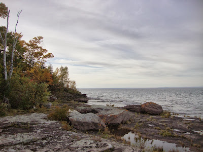
I asked the S.O. if he had known there was an actual park at Point Abbaye. Nope. Not a clue. I certainly didn't know it. There's nothing in the tourist literature we have at the museum, which includes a summer fun guide published by the local Tourist & Recreation Association to tell you it's there. The Backroads & Tourism Map put out by the Tourist & Recreation Association does include Pointe Abbaye as a place of interest but just says "An unmatched view of the Huron Islands and the Huron Mountains." Not one word about it being a park. If you Google "parks in Baraga County" a decent list comes up, but Pointe Abbaye isn't on it. There is also no signage whatsoever until you actually pull into the parking lot. The only thing that keeps you pointed in the right direction is seeing the road sign for Pointe Abbaye Road at the intersection with Townline Road. After that, it's a matter of just sticking with what appears to the most traveled road as it winds along the peninsula.

When I Googled Point Abbaye I did learn that last year the county wasted money on having U.P. Engineers and Architects draw up a development plan for the park. Obviously, this means that they do occasionally admit publicly that the park exists. Not surprisingly given the penchant of consultants to always think big, the proposed plans had a price tag of several hundred thousand dollars because they included building a power boat launch in addition to creating about a dozen rustic camp sites. Idiots. The two -- power boats and tent camping -- are mutually contradictory. A kayak and/or canoe launch would make perfect sense and cost almost nothing. People who kayak also like to tent camp. Power boaters? Not so much, plus the noise from power boating would really trash the quiet atmosphere the park has now. It's so far removed from everything else that the only noises you hear are natural ones. I have no idea whatever happened with the development plans, but my hope would be that anything they do to Point Abbaye would be low key: put in a picnic table or two, maybe clear a couple more campsites along the lake shore, and maybe, just maybe, put up a road sign or two to let people know the park actually exists.


